
In South Kirkby on Tuesday, I passed a derelict building and took this photograph:-

I had no idea what purpose the building had once served so I searched Google Streetview for some answers. You may not be aware of this but within Streetview you can often find imagery from different years and for South Kirkby you can look at the place from seven different points in time - beginning in April 2009 and moving on to April 2021.
Here's an image from April 2009. The car park is rammed and the place is clearly thriving.

By August 2011, the place seems much quieter but the grounds are still nicely maintained:-

Now we have reached 2016 and the almost abandoned property is up for sale

Moving on to April 2021, the site is now neglected and security barriers have been erected in the forlorn hope of keeping vandals and other ne'er-do-wells out

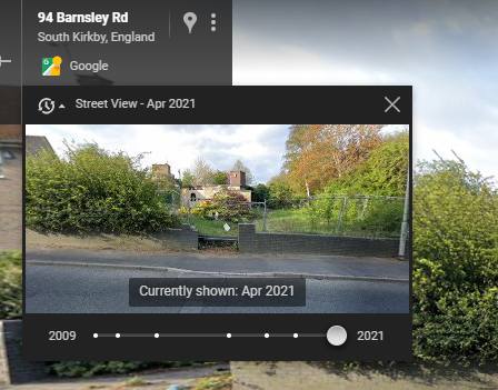
Below I have snipped the top left hand corner of the current Streetview scene. Each of those white dots on the scale allows visitors to look back at historical imagery. It is still there though superseded by the latest imagery.
By the way, I found out what the building was used for in the past. It was a health centre that hosted the South Kirkby CMHT. CMHT stands for Community Mental Health Team. I guess that funding issues and so-called "rationalisation" meant that this service became more centralised as satellite centres like the one at South Kirkby were shut down.
from Yorkshire Pudding https://ift.tt/Kz7xijO
