On Carl Wark looking towards Higger Tor
Another bright winter's day before different weather arrives - wet and warmer. With Clint I headed out to the top of The Burbage Valley ready for an almost three hour walk. Many of the paths were treacherous - coated with ice. One careless step and you can be down. It's easy to break ribs or a hip.
The rocky southern edge of Higger Tor
I was down in the bottom of the valley by Burbage Brook and then I schlepped through a pine plantation before making my way up the valley side, heading for the rocky plateau that is Higger Tor - a name as familiar to me as a friend's name.
Frozen puddles on Higger Tor looking like a monster's eyes
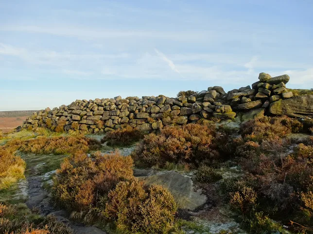
From Higger Tor I walked south to Carl Wark which was once turned into a hill fort - perhaps older than defences built in connection with the Roman invasion of Britain between 43 & 47AD. At the western end of the one acre plateau, our forebears built a wall to deter attack.
Ancient boundary wall on Carl Wark - once a hill fort
At the eastern end of the plateau I eased down the precipitous edge, making sure than I did not fall. No need to rush. Just make every bootstep secure. Lowering my body down between the stones. Then over Burbage Brook via a little packhorse bridge.
Frozen puddle in Burbage Valley
Freezing temperatures can work artistic wonders upon water, including random puddles. See above.
Clint on the far right - parked near Upper Burbage Bridge
Here I am cheating the picture sequence in this blogpost because I took the photo of Clint near the moorland bridge soon after setting off. By 3.45pm - when the walk was over - the light was much gloomier than that as another long December night was already elbowing the day away.
Upper Burbage Bridge is a ten minute drive from our house.
from Yorkshire Pudding https://ift.tt/P4HKxfb


